Local scale
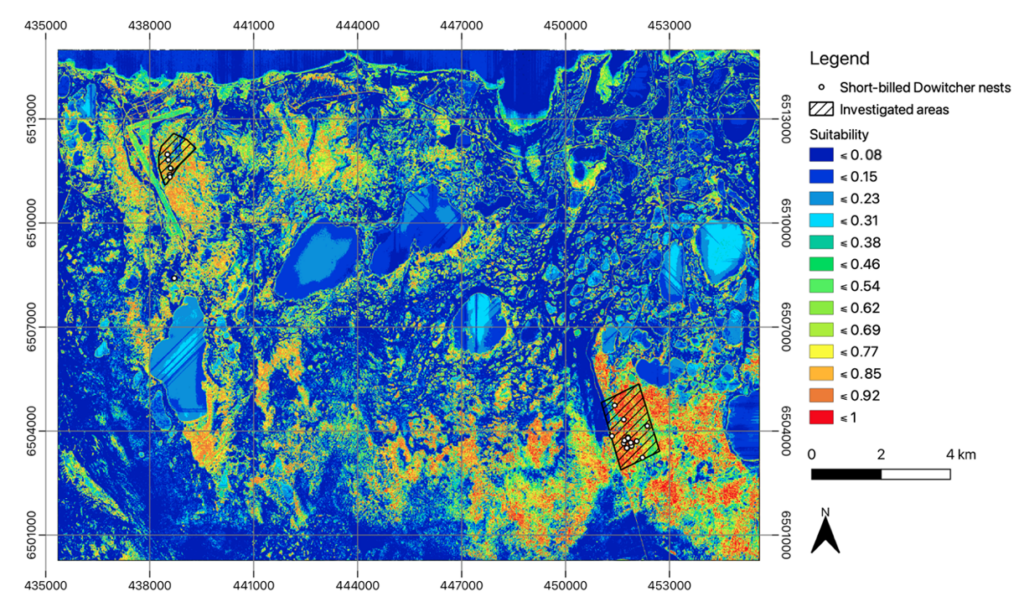
- Plenty but patchy and scattered potential suitable nesting habitats throughout the local area were identified.
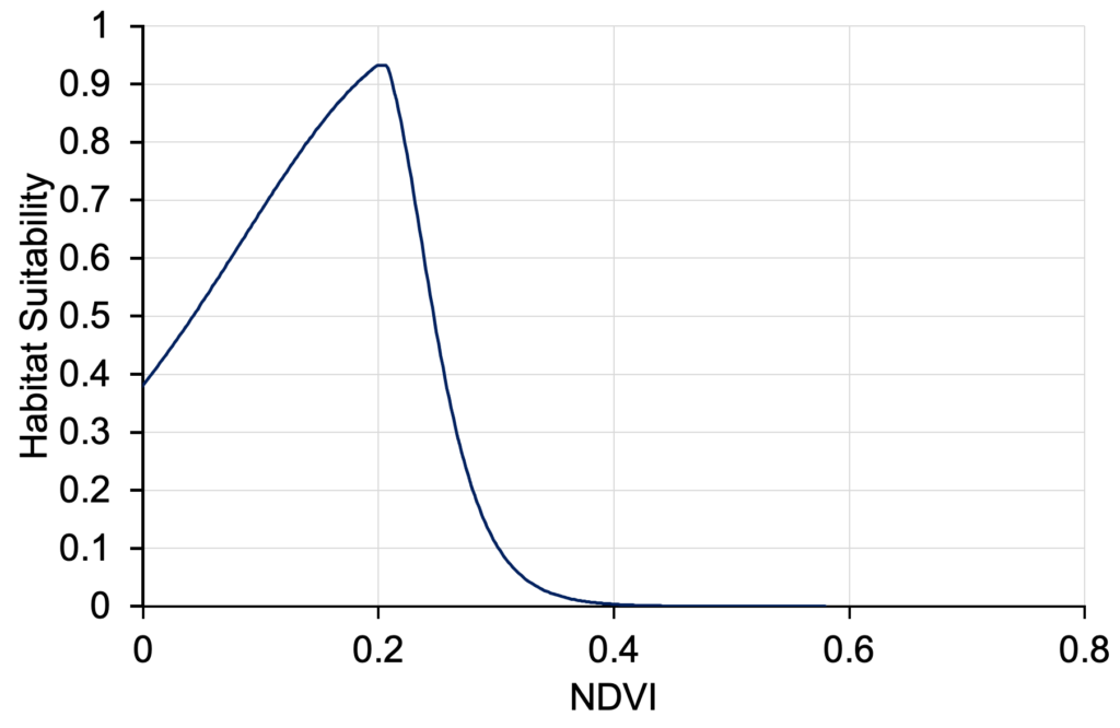
- NDVI is the variable that contributed most to the model, well before all other variables
- The highest habitat suitability was reached for NDVI value between 0.12 and 0.21.
Regional scale
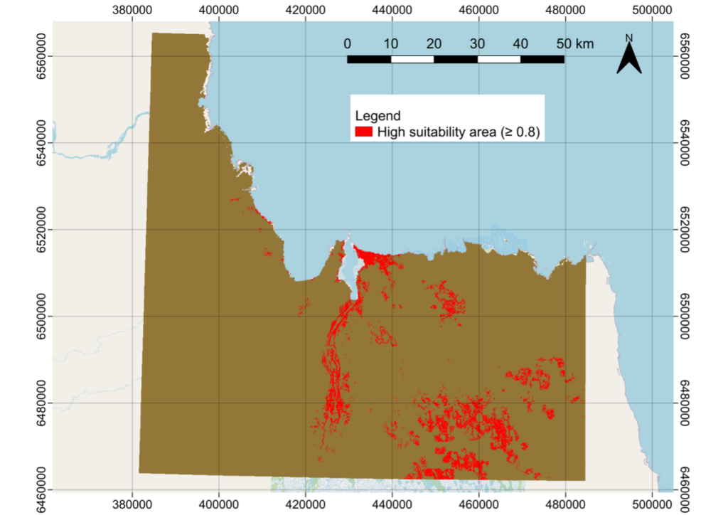
The potential distribution of suitable breeding habitat under the current conditions shows a patchy regional suitability pattern with high suitability areas inland, along the coastline, and along the Churchill River. This pattern encompasses both nesting and feeding habitats.
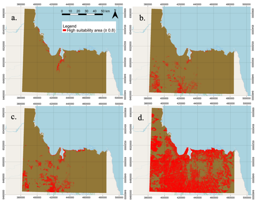
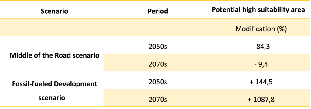
Projections for the years 2050s and 2070s were made under two climate change scenarios: SSP245 (“Middle of the Road”) and SSP585 (“Fossil-fueled Development”). SSP245 represents moderate efforts to limit global warming to 2.1-4.3°C above pre-industrial levels, while SSP585 portrays a future with rapidly increasing greenhouse gas emissions and a temperature increase of around 3.8-7.4°C by the end of the century.
Depending on the different scenarios, there is a significant increase in potential breeding habitat in response to climate change at a regional scale.